Last updated August 28, 2026 · Editorial policy
Vancouver’s public transport (TransLink) is excellent — the SkyTrain automated light metro, SeaBus ferry, and bus network connect the city, suburbs, and airport efficiently. The Canada Line from the airport to downtown takes 25 minutes. The city centre, Gastown, Chinatown, and Granville Island are walkable, and the Stanley Park Seawall is one of the world’s great urban bike paths. For reaching Whistler, the Sea-to-Sky Highway is a spectacular drive, and BC Ferries connect to Vancouver Island and the Gulf Islands. The city is compact and very liveable — most visitors find they don’t need a car.
More: When to visit Vancouver · Vancouver travel guide
Transport Options:
1. SkyTrain
Three automated lines — Expo (blue, downtown to Surrey), Millennium (yellow, VCC-Clark to Lafarge Lake), and Canada Line (grey, Waterfront to Richmond and YVR Airport). The Canada Line reaches YVR airport in 25 minutes from downtown (5 CAD + fare). Single fares are 3.15 CAD (1 zone, covers central Vancouver) to 4.45 CAD (3 zones). Use a Compass Card for discounted fares. Trains run every 2-6 minutes, 5 AM to 1:15 AM. Key stations: Waterfront (SeaBus, downtown), Stadium-Chinatown, Commercial-Broadway, VCC-Clark.
2. Buses
TransLink operates 200+ bus routes. Key tourist routes: 99 B-Line (rapid bus, Broadway corridor), 19 (Stanley Park), 50 (False Creek). Same Compass Card fare as SkyTrain. Buses run from 5 AM to midnight-ish depending on route. Night buses (N prefix) run limited routes after midnight. Real-time tracking via TransLink app or Google Maps. The bus to Grouse Mountain (236 from Lonsdale Quay) avoids driving. Buses are the way to reach neighbourhoods between SkyTrain stations — Main Street, Commercial Drive, Kitsilano.
3. SeaBus
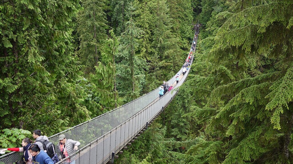
A 12-minute passenger ferry crossing Burrard Inlet from Waterfront Station to Lonsdale Quay in North Vancouver. Same fare as SkyTrain/bus with Compass Card. Runs every 15 minutes, 6 AM to 1 AM. The crossing offers views of the downtown skyline, mountains, and harbour. From Lonsdale Quay, connect to buses for Grouse Mountain (Skyride gondola), Capilano Suspension Bridge, and Lynn Canyon. The SeaBus is practical transport and a scenic experience.
4. Cycling and Seawall
Vancouver is one of North America’s best cycling cities. The Stanley Park Seawall (10 km loop) is the iconic ride. The Seaside Greenway connects False Creek, Kitsilano Beach, and Stanley Park. Mobi bike-share (3.50 CAD/30 minutes via app) has stations throughout downtown and surrounding neighbourhoods. Dedicated bike lanes on major streets. Rental shops on Denman Street near Stanley Park offer bikes from 8-15 CAD/hour. The seawall ride — 28 km from Convention Centre to Spanish Banks — is world-class.
5. BC Ferries to Vancouver Island
BC Ferries from Tsawwassen terminal (45 minutes south of downtown) to Swartz Bay (for Victoria) takes 1.5 hours. From Horseshoe Bay (30 minutes from downtown) to Nanaimo takes 2 hours. Walk-on fare about 18 CAD, vehicles from 60 CAD. Ferries run every 1-2 hours. Book in advance for vehicles during summer and holidays at bcferries.com. The sailing through the Gulf Islands is beautiful. The Pacific Coach Lines bus from downtown connects directly to the Victoria ferry.
6. Driving to Whistler (Sea-to-Sky Highway)
Highway 99 from Vancouver to Whistler (125 km, 1.5-2 hours) is one of the world’s most scenic drives — following Howe Sound, passing Shannon Falls, and climbing through Coast Mountains. The highway is well-maintained and mostly two-lane. Whistler has parking (some free, some paid). Winter conditions require winter tires (mandatory October 1 to April 30). The Squamish Gondola (about halfway) is worth a stop. Alternatively, the YVR Skylynx shuttle bus runs to Whistler (2.5 hours, from 35 CAD one-way).
Transport Tips for Vancouver
Buy a Compass Card at any SkyTrain station (6 CAD refundable deposit). The DayPass (11.25 CAD) offers unlimited travel across all zones. The Canada Line from the airport to downtown is the best airport connection — skip taxis. Stanley Park is best by bike — rent on Denman Street. The Aquabus and False Creek Ferries (small private ferries) connect Granville Island, Olympic Village, and David Lam Park cheaply. Don’t rent a car for downtown — parking is expensive and the SkyTrain/bus system covers everything. For Whistler, drive (Sea-to-Sky Highway is spectacular) or take the Skylynx shuttle.
What is the best way to get around Vancouver?
The most practical options are SkyTrain and Buses. Three automated lines — Expo (blue, downtown to Surrey), Millennium (yellow, VCC-Clark to Lafarge La…
Do I need a car in Vancouver?
No. TransLink covers Vancouver well: SkyTrain (the Canada Line runs straight from YVR to downtown), buses, and the SeaBus to North Vancouver, all tap-payable with a credit card or Compass Card. Rent a car or grab an Evo car share only for Whistler, Squamish, or North Shore trailheads; downtown parking is pricey.
Is public transport safe in Vancouver?
Yes. SkyTrain, SeaBus, and buses are safe day and night, with Transit Police reachable by text at 87-77-77. Keep your phone tucked away around Main Street-Science World and East Hastings stops, where visible street disorder rarely involves riders.
Related Articles
Frequently Asked Questions
You Might Also Love


Written by
John Morrison is the founder and lead travel writer at Packzup. Over the past decade he has explored destinations across Africa, the Americas, Asia, Europe, the Middle East, and Oceania — always self-funded, never on a press trip.